
.png)
London - 23rd July 2026
FOR IMMEDIATE RELEASE
Wiltshire Council has used three years of connected vehicle data and imagery to investigate why drivers were not giving way at a junction outside Westbury.
The Council received reports from residents that drivers failed to stop or slow on Trowbridge Road, where traffic should yield to oncoming traffic on Bratton Road.
Taking an innovative approach, Wiltshire used connected vehicle data provided by Compass IoT to compare vehicle behaviour in 2024, 2025, and 2026. The data, sourced directly from vehicles already on UK roads, gives granular information including speeds and g-forces metre-by-metre.
“Using this type of data allows a different insight into understanding the issues motorists encounter on the network,” said Gareth Rogers, Traffic Engineering Manager at Wiltshire Council.
The data over the last three years showed the average vehicle travelled at free-flow speeds of 35.8mph to 37.9mph on Bratton Road, the priority route through the junction. However, concerningly, g-force data (which shows how intensely vehicles move) identified that harsh braking rose from 0% in 2024-5 to 16% for westbound vehicles this year, and a further 3% for eastbound.
Along Trowbridge Road, plotting vehicle speeds every few metres showed vehicles speeding up through the junction, with northbound speeds spread higher (from 19mph to 43mph) this year compared to previous years.
Harsh braking also increased. On the northbound approach it rose from 5% of vehicles in 2024 to 21% this year, and for southbound from 3% to 22%. Together, these pointed to a genuine and worsening conflict point.
The cause became clear when the data was paired with imagery from the connected vehicles themselves. Comparing 2024 Google Maps imagery against July 2026 Compass IoT imagery showed roadside hedges were overgrown (pictured below).
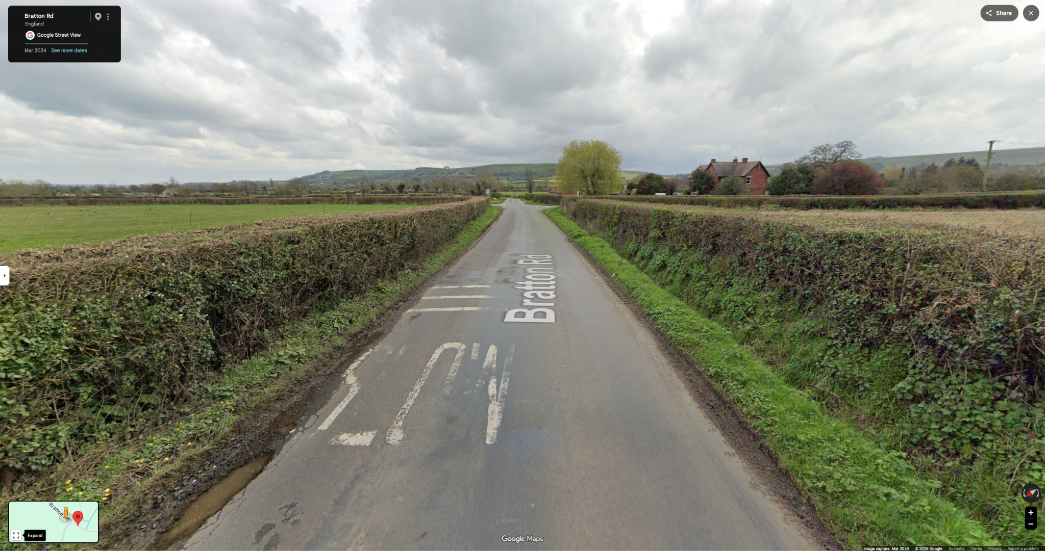

This growth blocked drivers’ view of oncoming traffic at exactly when a driver would make a give-way decision and slow. This impact was consistent with increased harsh braking.
Wiltshire Council has now trimmed the vegetation, restoring sightlines and re-exposing signage that was hidden in the overgrowth. Vehicle imagery captured this week shows the improved approach.
Like most British authorities, Wiltshire would otherwise rely on resident reports, STATS19 data and periodic site visits to flag safety concerns. That evidence base underpins every road safety audit across the UK, like the GG 119 standard. The limitation is that authorities must wait for problems and collisions to accumulate before action is taken. Connected vehicle data instead flags the warning signs and shows how drivers behave at every point on the approach.
Using this data, Wiltshire and other councils can gain a complete picture of what is happening on their roads and why without multiple site visits. Rather than dispatching staff to watch the junction or waiting for collisions, engineers can gain time-stamped evidence to action treatments sooner.
Wiltshire's approach is available to other councils across the UK. To see how connected vehicle data could support your network, contact the Compass team.
For further information
Teagan McKay
Head of UK/EU Marketing
About Compass IoT
Founded in 2018, Compass IoT is a multi-award-winning connected vehicle data aggregator that uses vehicle-generated insights to help transport professionals build better, safer, and more resilient cities. Compass provides granular insights to clients across Australia, New Zealand, North America, the United Kingdom, and Europe. Learn more at www.compassiot.com.au.
If you found this article interesting, you might want to check these ones out.
.jpg)

If you found this post interesting, you might also want to check out these.
.png)