A north Sydney council wanted to know if people were cutting through small streets instead of using the main road which disrupts residents.
Book a DemoIf it was found that people were using residential streets to avoid the main road, then the council wanted to reduce the instances of these rat runs.
Rat running is problematic because local roads cannot handle larger volumes, which can disrupt local communities and residents.

The council used connected vehicle data to answer the following questions: are vehicles using one or more shortcuts? Which shortcut is being used the most? Are there any other shortcuts in the area? What is the time difference between using the main road vs the local roads? and what percentage of drivers are using the shortcuts compared to the main road? The council also compared average travel time for the various paths taken, average speed for said paths, times of day (e.g. peaks and off peaks, school peaks, etc.), and percentage of vehicles using the rat running route
.png)
.png)
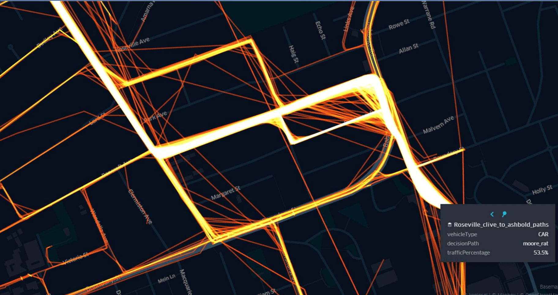
The council established that 48.9% of drivers were using shortcuts in the morning peak across different local roads and that more drivers used the local roads on weekdays compared to weekends. By enabling the council to gain insight into how drivers behave on these roads at certain times, there can be a clearer idea of how and where to prevent these rat runs.

Applications of vehicle-generated data for use cases across state-wide freight modelling, origin-destination studies, VMS signage effectiveness, road safety, and local area traffic management.

.png)